In the book "L&B Journey Barnstaple to Lynton and back", there is a picture from a 25in to the mile map of Barnstaple published by the Ordnance Survey in 1932 showing what looks like a railway track running by Rolle Quay on the other side of the River Yeo to the L&B track.
There are L&B track diagrams between Pilton Road and Braunton Road showing original (1913 OS) and revised layouts (1932 OS) in the book "The Lynton & Barnstaple Railway, Measured & Drawn" but these don't include Rolle Quay.
There is also an L&B modelling group which might be able to help. Lynton-and-Barnstaple-Modelling@groups.io
Lots of pictures if you search.
https://ehive.com/collections/4559/obje ... barnstaple
http://www.vimp.thepiltonstory.org/pict ... 9125fcb45e
Michael
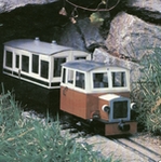
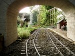
Lynton & Barnstaple Railway - Rolle Quay coaling siding
-
Southern188
- Cleaner

- Posts: 40
- Joined: Thu Jan 11, 2018 8:37 am
- Location: Dorset
Re: Lynton & Barnstaple Railway - Rolle Quay coaling siding.
That’s whats so great about our forum Chugg…very helpful members who want to please… 
ROD
Life is so easy when I run my trains.


https://gardenrails.org/forum/viewtopic ... 41&t=11364
https://www.youtube.com/@fairywoodlightrailway
Life is so easy when I run my trains.


https://gardenrails.org/forum/viewtopic ... 41&t=11364
https://www.youtube.com/@fairywoodlightrailway

Re: Lynton & Barnstaple Railway - Rolle Quay coaling siding.
My other hobby is Family History and there is an extremeley useful site of the National Library of Scotland. They have a huge map collection of the entire UK going back to the earliest maps.Southern188 wrote: ↑Fri May 18, 2018 11:56 am In the book "L&B Journey Barnstaple to Lynton and back", there is a picture from a 25in to the mile map of Barnstaple published by the Ordnance Survey in 1932 showing what looks like a railway track running by Rolle Quay on the other side of the River Yeo to the L&B track.
However, of relevance here is their "Georeference" facility which overlays the old maps interactively on current ones. It is possible to select both the old and modern maps to pinpoint whatever you are searching for, and the early OS maps are extremely detailed - I recently pinpointed the exact house occupied by a distant cousin who was the mechanical engineer in 1911 in the Nantle Quarries in N. Wales.
As far as Rolle Quay is concerned try this link:
http://maps.nls.uk/geo/explore/#zoom=14 ... yers=1&b=1
http://maps.nls.uk/geo/explore/#zoom=15 ... rs=168&b=1
You adjust the overlay transparency with the slider at bottom left and you'll have to experiment with the other controls.
Oh, BTW, I forgot to mention, it's all completely FREE!!!
Philip
-
Southern188
- Cleaner
- Posts: 40
- Joined: Thu Jan 11, 2018 8:37 am
- Location: Dorset
Re: Lynton & Barnstaple Railway - Rolle Quay coaling siding.
Thanks Philip. That means for completion I can attach an image from their website which is the same as in the book. From their website, for copyright, I have to include the following link.
https://maps.nls.uk/index.html
https://maps.nls.uk/index.html
- rolle quay.jpg (239.16 KiB) Viewed 4129 times
-
Soar Valley Light

- Driver

- Posts: 1453
- Joined: Sun Dec 08, 2013 5:18 pm
- Location: North West Leicestershire
Re: Lynton & Barnstaple Railway - Rolle Quay coaling siding.
Hi All,
Being a 'proper' railway, the L&B provided trap points at the exit from non running lines. These were generally single bladed trap points so what appears to be shown as a 'full-on' turnout (to nowhere?) at the exit from the Rolle's Quay siding is very intriguing. I dare say we'll never know it's purpose.
Andrew
"Smith! Why do you only come to work four days a week?
"'cause I can't manage on three gaffer!"
"'cause I can't manage on three gaffer!"
Who is online
Users browsing this forum: No registered users and 1 guest